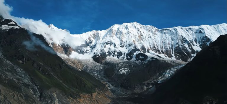
Everest rarely stands alone in a photograph. Ask anyone who has walked into the Khumbu and they will tell you the same thing. The mountain that gives the region its fame shares the skyline with a crowd of formidable neighbors, and more often than not, it is those neighbors that steal the frame first.
This is a diary of that walk, and of the peaks that keep Everest company.
Lukla to Phakding: The Approach
The trek begins with a landing that gets talked about more than almost any other in the world, the short runway at Lukla tucked against a hillside at 2,860 meters. From here the trail drops gently toward the Dudh Kosi river, and the first big mountain of the trip is not Everest at all. It is Kusum Kanguru, a sharp fin of rock and ice that rises above Lukla and seems to announce that everything from here on will be measured against giants.
The walk to Phakding is short and easy, a good afternoon to settle into the rhythm of the trail: the clang of yak bells, porters moving at a pace that makes the trekking poles feel unnecessary, prayer flags strung across every bridge.
Namche Bazaar: The First Real View
Two days later, past the Sagarmatha National Park entrance at Jorsale, the trail climbs hard into Namche Bazaar, the unofficial capital of the Khumbu. Somewhere on that climb, through a gap in the pine trees, Everest appears for the first time. It looks smaller than expected, mostly because Nuptse sits directly in front of it, hiding the lower slopes and leaving only the summit pyramid and its permanent plume of wind-blown snow visible above the ridge.
That first glimpse is really a glimpse of three mountains at once. Everest at 8,849 meters, its neighbor Lhotse at 8,516 meters connected by the South Col, and Nuptse at 7,861 meters standing guard in front like a wall. From Namche, they look almost like a single massif, and it takes days of walking closer before the eye learns to separate them.
Namche itself is worth lingering in. It has bakeries with genuinely good cinnamon rolls, a Saturday market that draws traders up from Lukla and down from Tibet, and acclimatization day hikes up to the Everest View Hotel or the Syangboche airstrip, both of which offer wide, unobstructed panoramas.
Tengboche: Ama Dablam Takes Over
If Everest is the mountain people come to see, Ama Dablam is the one they fall in love with. At 6,812 meters it is far shorter than its famous neighbor, but its shape does all the work: a sharp central spire flanked by ridges that curve down like outstretched arms, with a hanging glacier caught between them that gives the mountain its name, meaning “mother’s necklace” in the local tongue.
The monastery at Tengboche, perched on a ridge at 3,867 meters, has arguably the finest mountain backdrop of any building in Nepal. Ama Dablam fills the eastern sky, and on clear mornings monks begin their prayers with Everest, Lhotse, and Nuptse lined up behind the gompa’s golden roof.
Dingboche and Pheriche: The Valley Widens
Past Tengboche the trail splits toward Dingboche, and the mountains start to change character. Ahead, Island Peak, known locally as Imja Tse, rises as a compact pyramid that looks climbable from a distance and is, in fact, one of Nepal’s most popular trekking peaks. To the north, Cho Oyu begins to show itself on very clear days, the sixth highest mountain on earth, standing at the Nepal-Tibet border on the far side of the Ngozumpa glacier system.
This is also where the altitude starts asking real questions. Dingboche at 4,410 meters is a standard acclimatization stop, and most itineraries build in a rest day here with a side hike up Nangkartshang Peak for views that stretch from Makalu in the east to the Cho Oyu region in the west.
Lobuche and Gorak Shep: Into the Amphitheater
The final approach to base camp runs along the lateral moraine of the Khumbu Glacier, past a string of stone memorials built for climbers who never came home from the mountains above. It is a sobering stretch of trail, and a quiet one.
At Gorak Shep, a flat, sandy basin at 5,164 meters, the mountains close in on every side. This is the amphitheater, with Pumori standing sentinel to the northwest, Nuptse’s full ridgeline finally visible edge to edge, and the icefall of Khumbu itself, the first great obstacle on the climbing route to Everest’s summit, spilling down just ahead.
Kala Patthar: Where Everest Finally Stands Alone
From Everest Base Camp itself, ironically, Everest is barely visible, blocked by the shoulder of Nuptse. The real reward is Kala Patthar, a rocky outcrop above Gorak Shep at 5,644 meters, usually climbed before dawn.
It is worth the cold, dark start. From the top, Everest finally stands clear of its neighbors, flanked by Lhotse and Nuptse but no longer hidden behind them, its summit catching the first light of the morning long before the sun reaches the valley floor. To the west, Pumori frames the scene. To the north, the peaks of Tibet stretch out in a jagged line.
The Companions, Named
By the end of the trek, the mountains stop being background scenery and start feeling like a cast of characters: Nuptse the gatekeeper, Ama Dablam the showpiece, Lhotse the quiet giant standing shoulder to shoulder with Everest, Pumori the elegant outlier, Cho Oyu the distant sixth-highest, and Island Peak the approachable one, climbable by trekkers who want to go one step further than base camp.
Everest gives the region its name and its fame. Its companions are what make the walk unforgettable.
Planning a trip into the Khumbu? IATE runs Everest Base Camp treks, Gokyo Lakes routes, and shorter Everest region itineraries throughout the year, with departures timed around the best visibility windows in spring and autumn.